
Drone Aerial Photography & Video Imaging Services

Building & Roof Inspection
commercial & residential inspection & maintenance
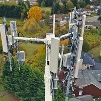
Infrastructure Inspection
bridge, pipeline, power grid and cell broadcast towers
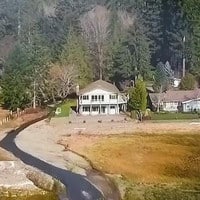
Real Estate
residential and commercial – sales, view studies, pre-sale

Drone Videography Tourism
resort, golf, attraction, destination marketing
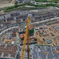
Construction
project management, volumetrics, safety, finance
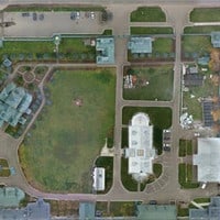
Surveying / Mapping
topographic surveys, large area mapping

Precision Agriculture
NDVI crop health, irrigation analysis, golf turf management

Drone Events, Weddings
outdoor weddings, sports & corporate events
Professional, Technical & Reliable Aerial Photography & Video
Nadar Drone Photography & Video provides Professional Aerial Imaging Services. All of our pilots are FAA Certified. Our primary area of service is currently Washinton State including the Greater Seattle Puget Sound area all the way to the Tri-Cities. We also handle large projects in the Greater Portland, Oregon area. We produce high-quality results with unsurpassed customer service.
